Introduction
Based on the responsibility of hillside conservation and utilization, the Water and Soil Conservation Bureau of the Agriculture Committee of the Executive Yuan has successfully built 21 fixed land-rock flow observation stations, one landslide observation station, and two sediment concentration stations in the catchment area of Shimen Reservoir since 1991. The construction of observation stations a total of 24 fixed observation stations were built.
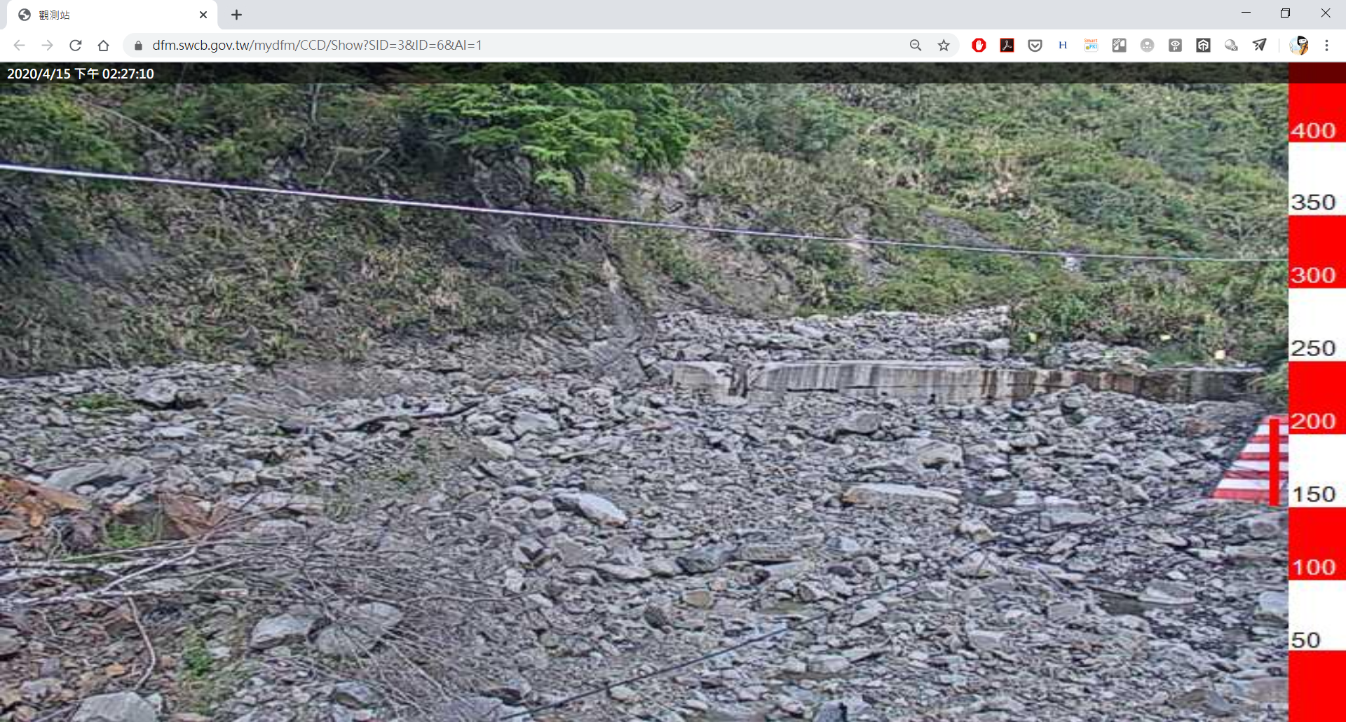
To strengthen disaster prevention monitoring and analyze the occurrence factors of landslide flow and expand the observation range of landslide flow, in addition to erecting fixed landslide flow observation stations in key areas, 3 stations of mobile observation stations, 17 stations of simple landslide flow observation stations and 1 station of a mobile barrier lake Observation stations are dispatched to landslide potential streams or disaster areas for monitoring in response to typhoon torrential rain paths.
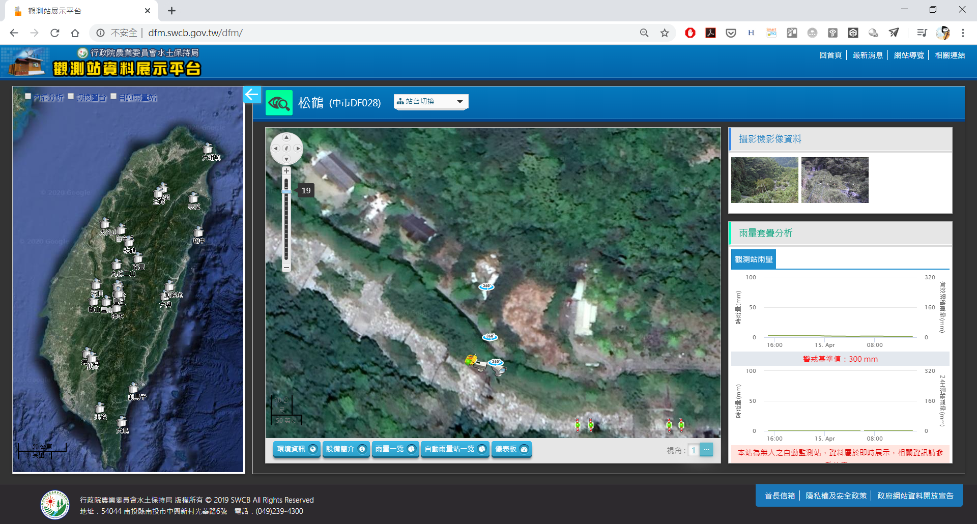
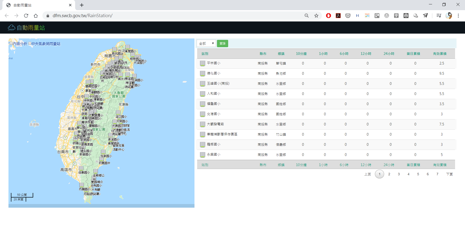
In addition, 63 stations of automatic rainfall stations were built to strengthen the alert and release the accuracy and maintenance. During the flood control period, various observation stations integrated real-time information on the potential streams of landslides into the landslide disaster prevention and response system of the Bureau of Soil and Water Conservation to provide decision-making reference for disaster prevention units at all levels.

Project performance and benefits
The company assists the Water and Soil Conservation Bureau of the Agriculture Committee of the Executive Yuan to build and maintain 24 fixed observation stations, 3 mobile stations, 17 simple land-rock flow observation stations and 1 mobile barrier lake observation station. During the contingency period, in cooperation with the central competent authority's contingency decision-making, mobile and simple landslide observation stations are dispatched to disaster-prone areas to perform observation tasks.
All kinds of observation data (rainfall, soil moisture content and geoacoustic data, etc.) are sent back to the back-end system of the Soil and Water Conservation Bureau in real time through satellite communication, ADSL or 4G mobile communication network, and the integrated response system provides disaster prevention units with decision-making.