Introduction
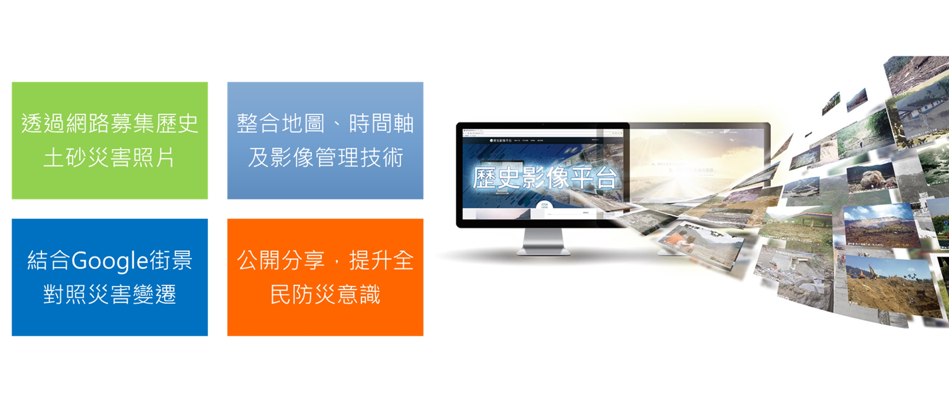
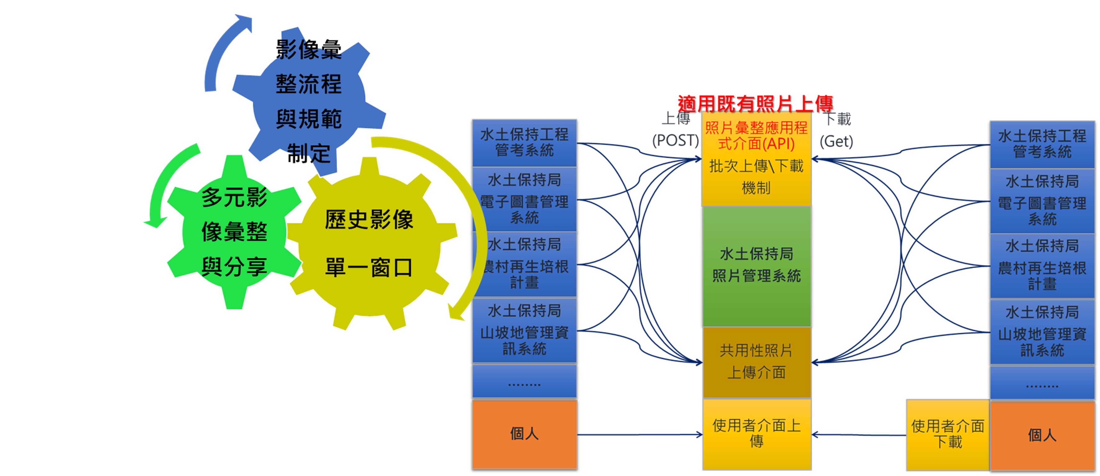
The historical image platform is mainly to solicit photos of historical disaster events through the power of the public community, and at the same time act as a single window for the collection of other business-related photos of the Soil and Water Conservation Bureau.
Including records such as hillside conservation and management, rural construction, or photos taken by remote-controlled unmanned vehicles.Any photos taken or purchased by the executive or involved in the business duties of the Bureau of Water and Soil Conservation or various sub-bureaus, or photos taken by remote-controlled unmanned vehicles are all the scope of management is to achieve the purpose of a single circulation supply of photos of the Soil and Water Conservation Bureau.

Project performance and benefits
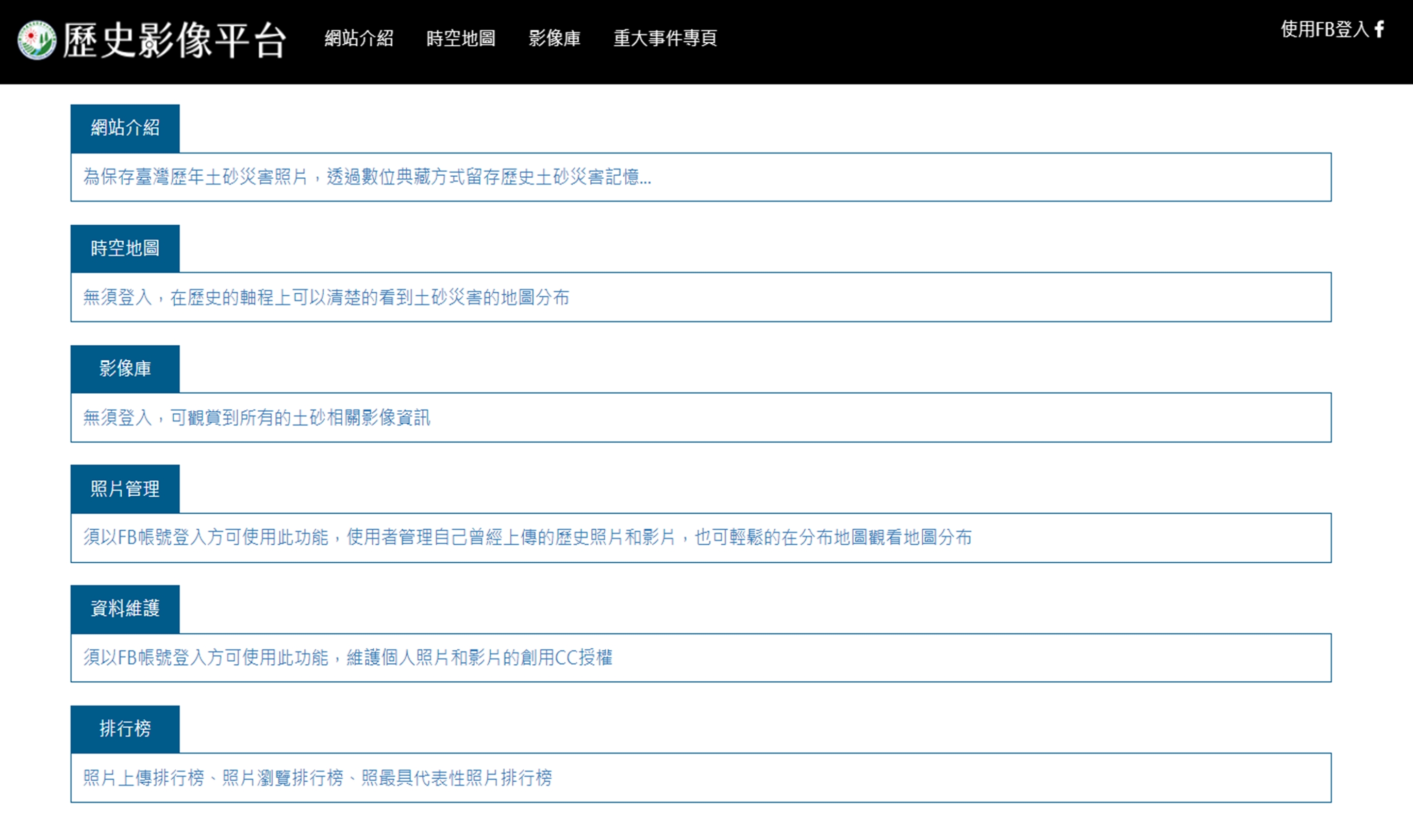
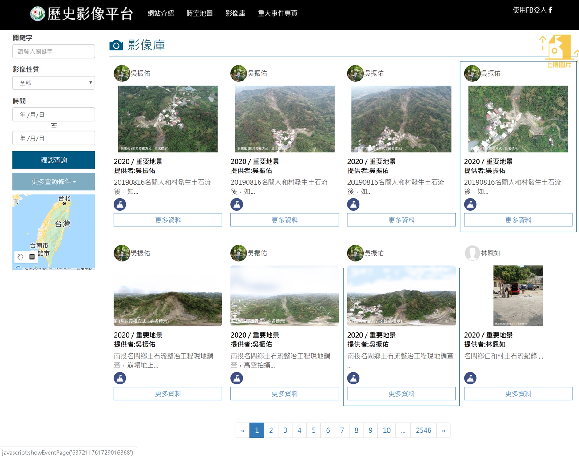
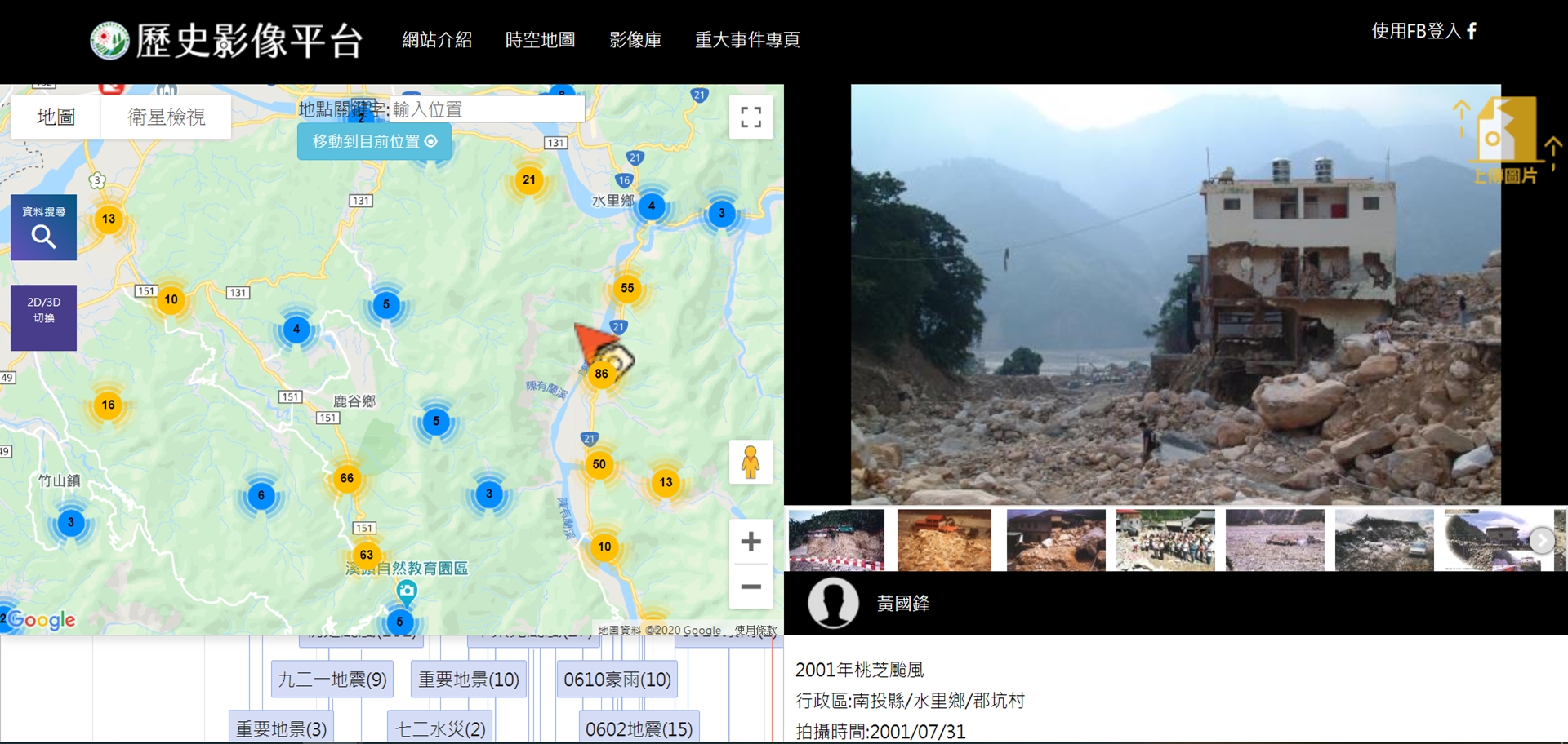
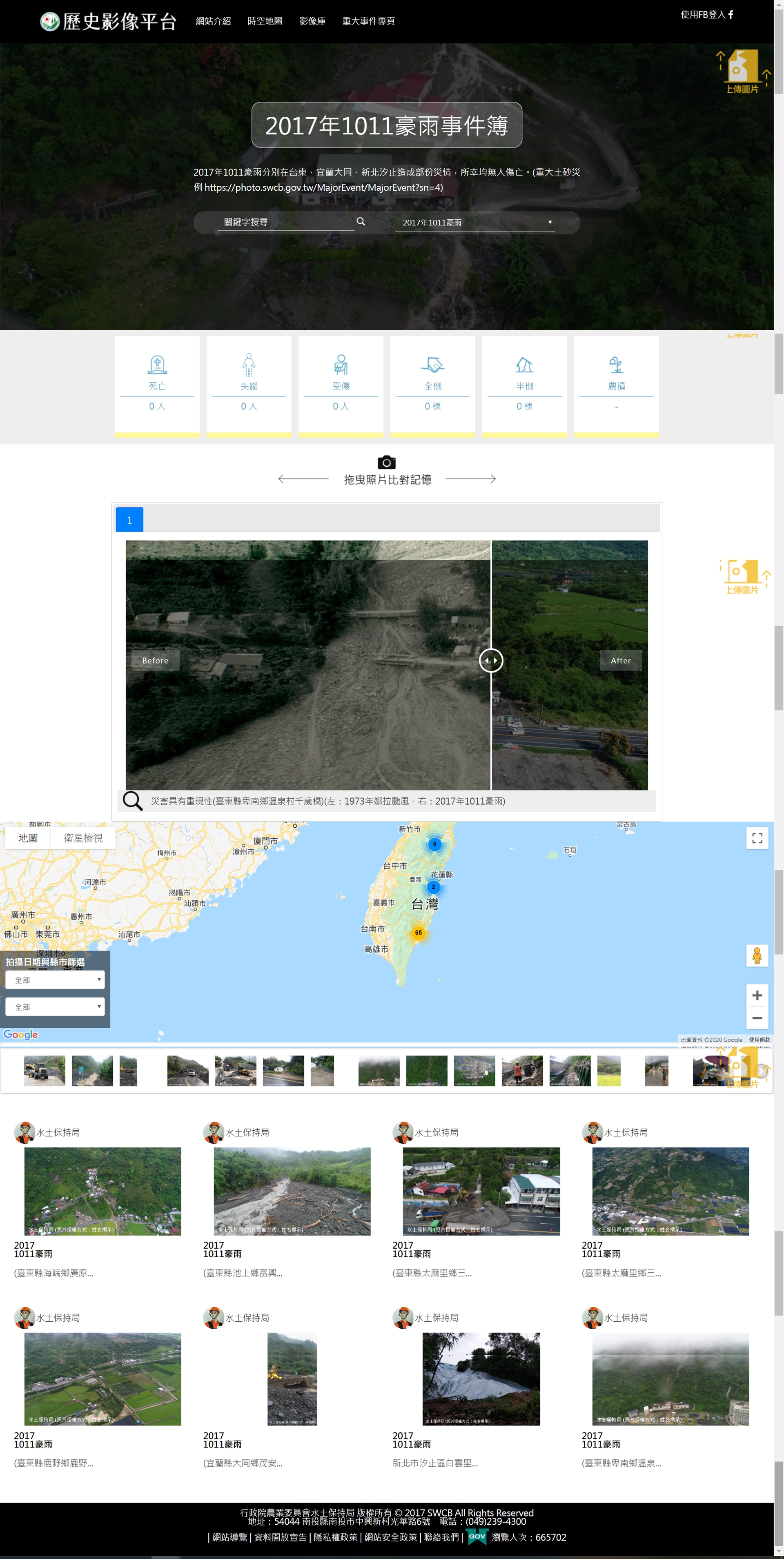
The historical image platform integrates maps, timelines, and image management technologies, so that each photo has four essential elements: "image", "location", "time" and "story". Through time or space query, you can understand Images of disasters that occurred in the queried area in the past, and even combined with Google Street View to quickly compare the changes in the past and present.