Technical Services
Introduction
A typhoon is a natural disaster, and it cannot change its path or rainfall, thereby preventing its heavy rain from causing disasters.
Therefore, in the early warning of landslide disasters, understanding rainfall's temporal and spatial distribution is a critical link in disaster prevention.

Project performance and benefits
Through the analysis of the typhoon warning period from 2012 to 2016, the study of 204 reference rainfall stations, and the comparison of surface observation rainfall and quantitative rainfall estimation (QPE) estimated rainfall characteristics distribution in different rainfall stations and different typhoon events:
-
Features of this product:
- Analyzing the distribution of the estimated differences in the maximum effective cumulative rainfall of 204 rainfall stations in 28 typhoon events, the results show that the proportion of underestimation is high (22%). There is a linear relationship between the surface observed rainfall and the QPE estimated rainfall on the maximum adequate cumulative rainfall (the slope is about is 0.8), because the proportion of underestimation is too high, this feature must be considered in subsequent applications.
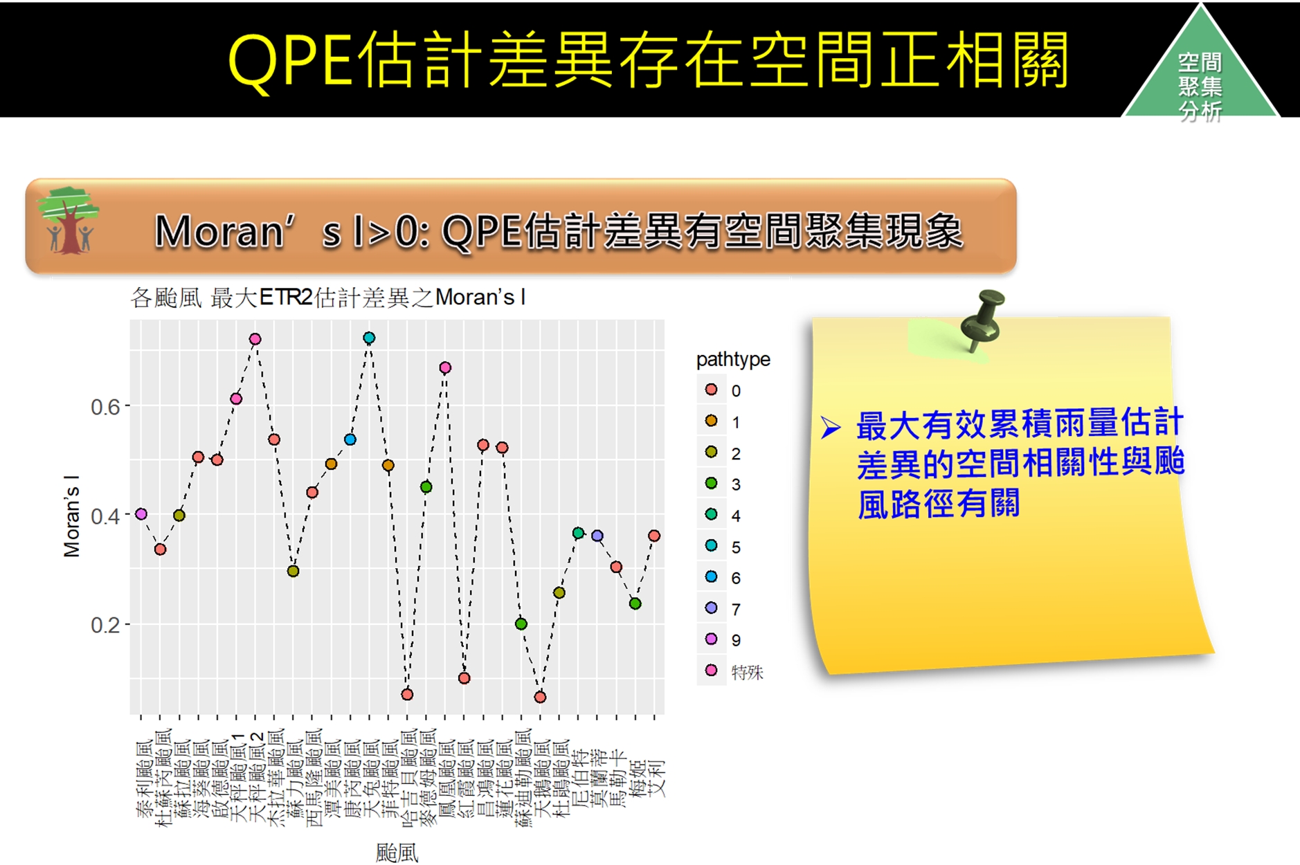
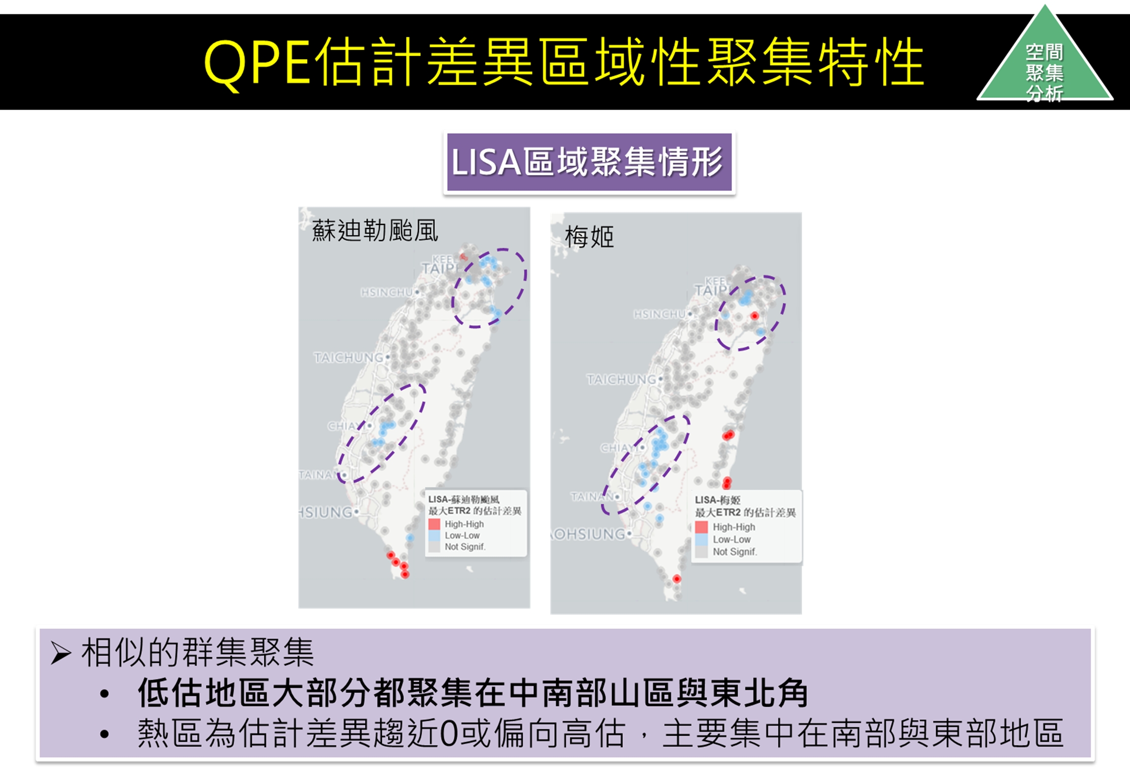
- Through the dependence of positive spatial autocorrelation (p-value < 0.01), it is found that the spatial autocorrelation of the difference in the estimated maximum effective cumulative rainfall is related to the typhoon track.
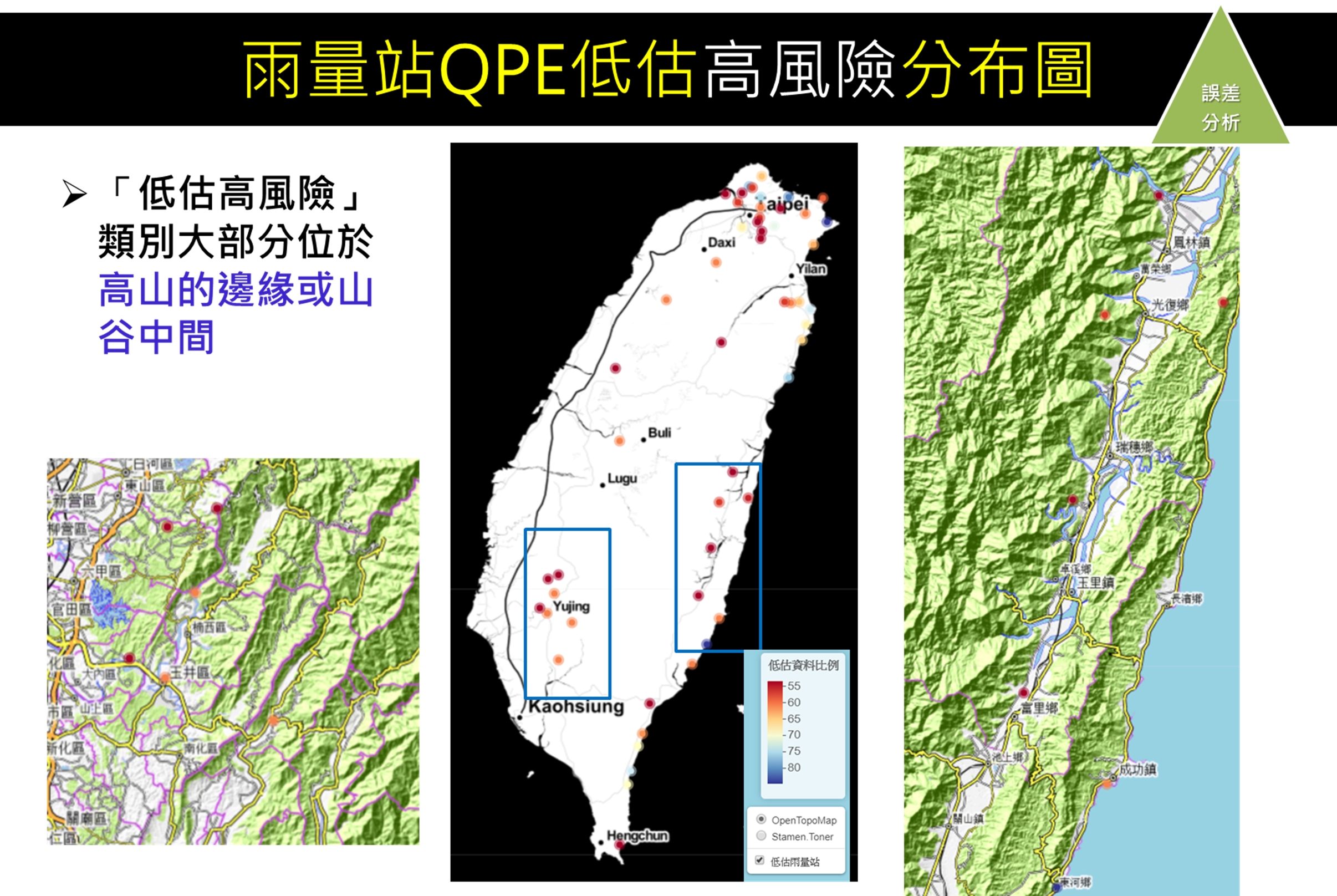
- Through the analysis of variance, it is found that the combination of typhoon track and typhoon intensity is related to the QPE estimation error, and it is found that the location where QPE cannot effectively estimate rainfall is distributed on the edge of the mountain. The selection of QPE as a virtual rainfall station in the future should be avoided as much as possible edge.