Introduction
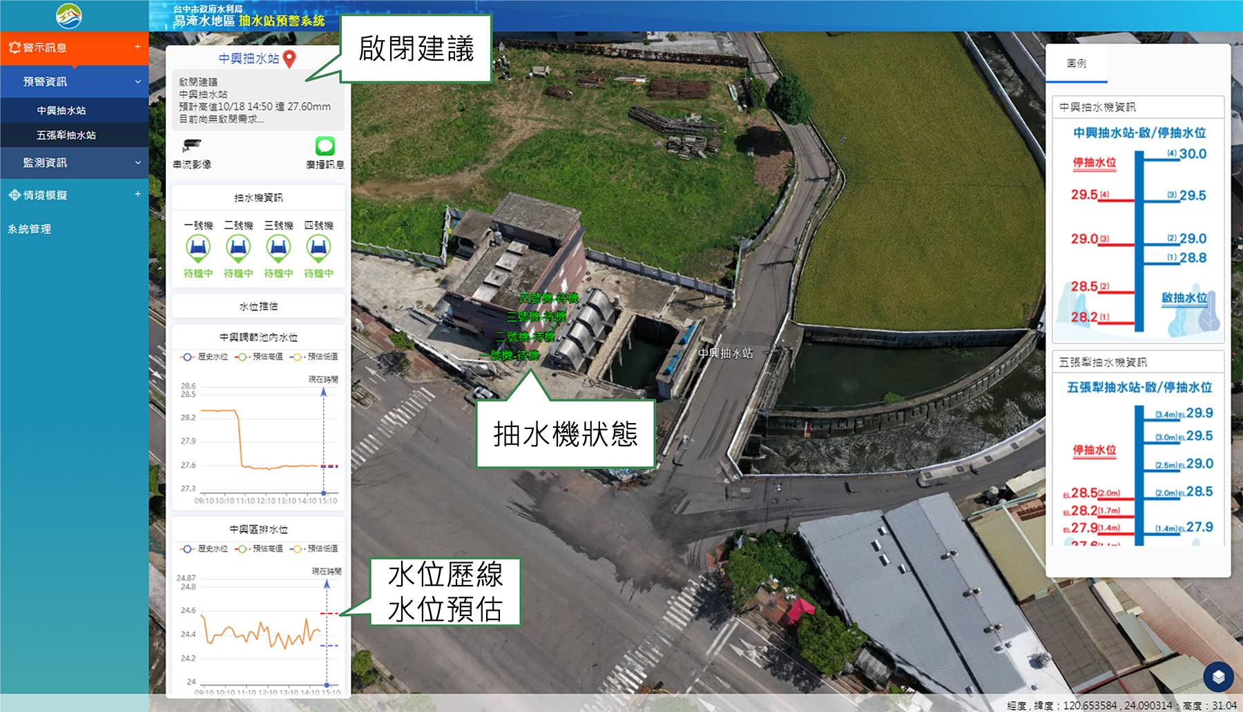
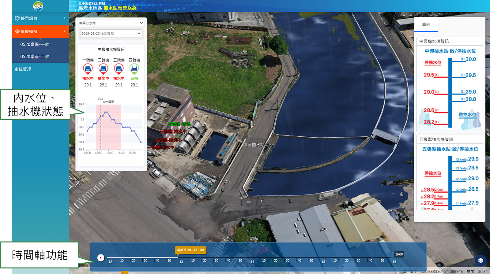
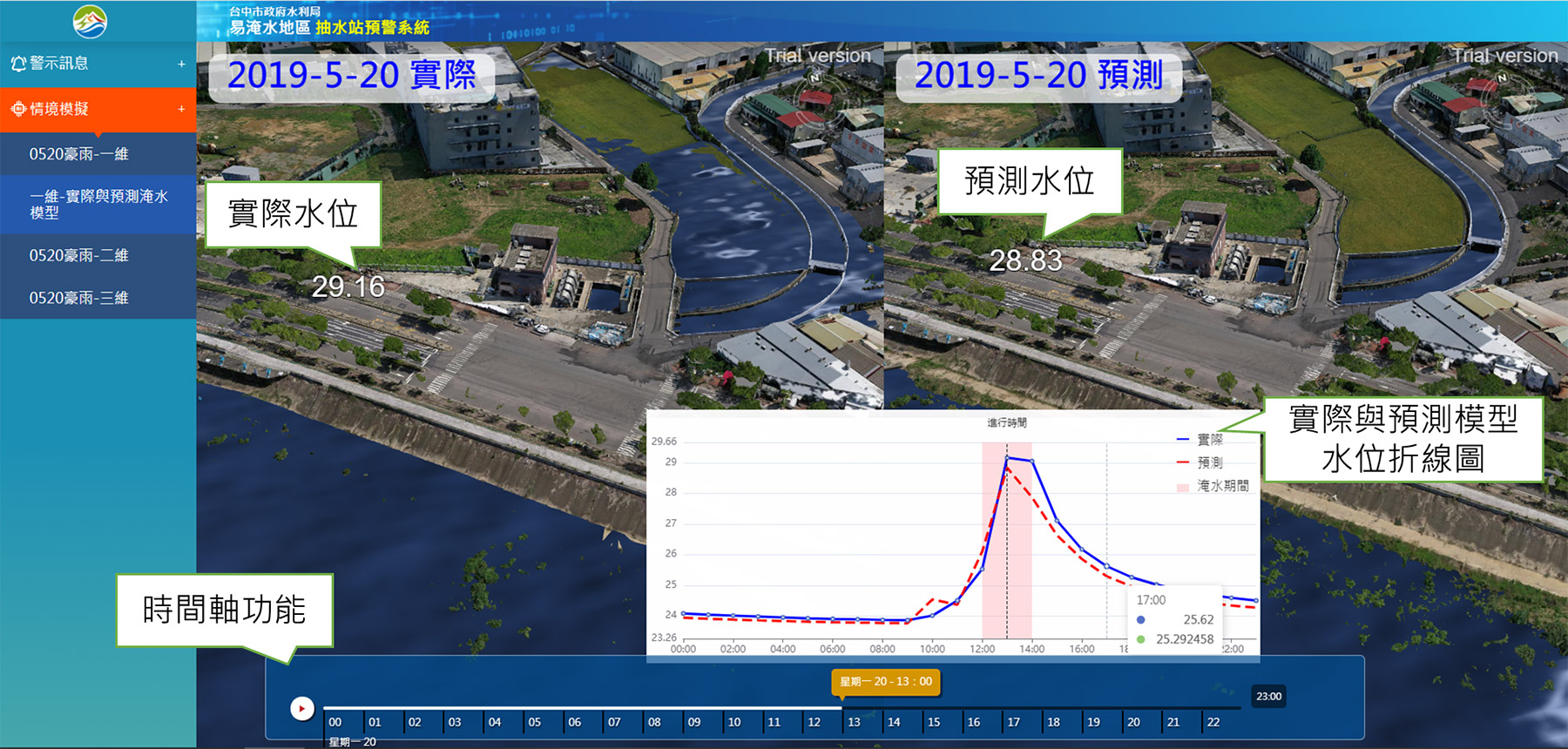
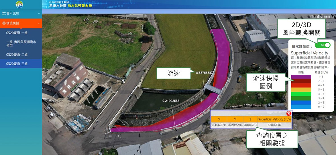
In order to understand the causes of flooding in Guangming Village and Wuguang Village, Wuri District, and Xiatian Village, Dali District in Taichung City, This project cooperates with the Water Resources Bureau of the Taichung City Government, taking the areas prone to flooding near Zhongxing Pumping Station and Wuzhangli Pumping Station as the early warning area, and building an early warning system for pumping stations in flood prone areas in the cloud computer room of the National Center for High-performance Computing, and interfacing Monitoring data related to the water regime in the Greater Taichung area, and applying a large amount of monitoring data to flood-prone areas for disaster prevention. At the same time, an automatic warning function is established for early warning, and suggestions for opening and closing pumps at pumping stations are provided. Through the 3D model produced by UAV aerial images and the 3D GIS map simulation analysis of one-dimensional river, two-dimensional flooding, three-dimensional flow field and other situations, through the situational simulation, try to find out the cause of flooding in historical events, gradually solve the problem of easy flooding near the pumping station.。

Project performance and benefits
Strengthen pre-disaster preparations, response during disasters, and post-disaster assessment
By estimating future river water level changes and automatically alerting pumping stations to open and close pumping suggestions, relevant personnel can make preparations in advance, greatly reducing the manpower and time costs for notifications between units, and striving for the golden time for pre-disaster preparations.
Using the 3D model and flood simulation, combined with the actual measurement data of the flood sensor, the affected area and flood depth can be quickly analyzed, disaster prevention and response reference can be effectively carried out, and disaster damage can be further evaluated.
Through the import of water regime monitoring data and time axis analysis, check whether the internal water cannot be discharged smoothly due to external water jacking up at each time point, or the drainage section is insufficient, etc., to understand the cause of flooding and disasters, as an important reference for the overall flood reduction and regulation of subsequent pumping station operations.
Improve the effectiveness of governance projects
In the case of limited resources, the improvement of engineering construction should be properly planned. Through the 3D model and scenario simulation settings, the flow velocity of the river can be known and the flow can be estimated, which can be used as a reference for subsequent treatment projects to increase flood drainage capacity. It is hoped that in the future, we can find out the gaps in flood control and prescribe the right medicine, and effectively use funds to do a good job in flood control and preparation.