Introduction
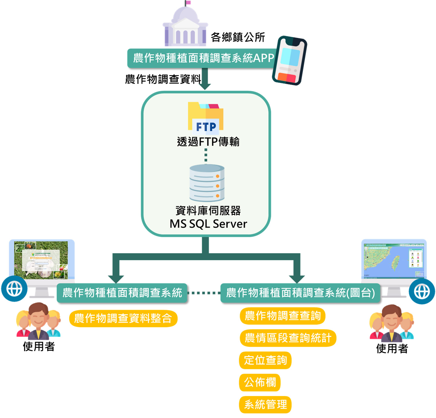
To improve the mastery and accuracy of agricultural production, the Agriculture and Food Administration of the Council of Agriculture, Executive Yuan, surveyed the planting area of crops based on cadastral data in response to the price of agricultural products and the allocation of production and sales.
The crop planting area system is the basis of the overall construction, and a customized management system is provided for specific crops. The source of the data is the on-site survey conducted by the township offices and will be sent back to provide spatial distribution and query applications for the data. Through the spatial overlapping calculation of the geographic information system, the crop planting area data is counted and the crop planting distribution spatial information is established.
In addition, the map platform also collects historical digitized maps of various villages and towns, includingKML/SHP/PDF and other data, and provides the latest version of the map data download channel , allowing users to download the original map data for value-added applications and PDF files for printing use.

Project performance and benefits
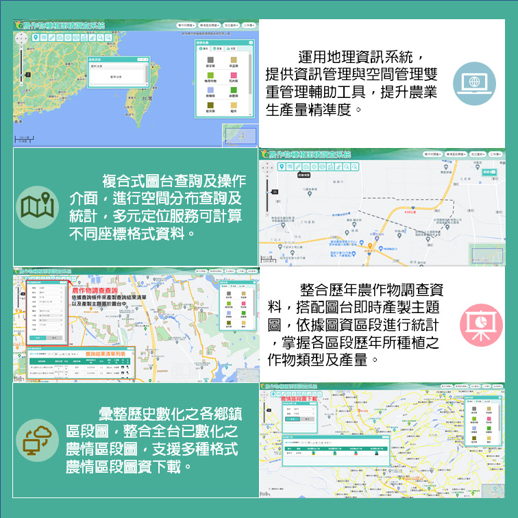
The crop planting area survey system map table uses the geographic information system (GIS) to establish the spatial information of crop planting distribution, and provides dual management auxiliary tools for information management and space management to improve the accuracy of agricultural production.
Integrate the crop survey data over the years, and can produce thematic maps in real time with the map station. Based on the cadastral map, farmland mound map or river public map, and then dynamically check with the latest survey data in the system database, according to the planting land and crops Classify or whether crops are planted to produce thematic maps. Users can query and make statistics on spatial distribution through the compound query interface.
In addition, statistics can be made according to the agricultural situation section, which is convenient for grasping the types and yields of crops planted in each section over the years, and integrates the digitized agricultural situation section map of the whole Taiwan, and provides the agricultural situation section map data download, this map The station also includes a variety of positioning services: administrative area, coordinates, lot numbers, sections and landmarks, addresses and other positioning functions. Positioning can be performed according to different coordinate formats. The rich positioning functions can quickly achieve the positioning goal. Spatial analysis statistics can also be stacked through layers, and different statistical units can be aggregated through spatial analysis.