Introduction
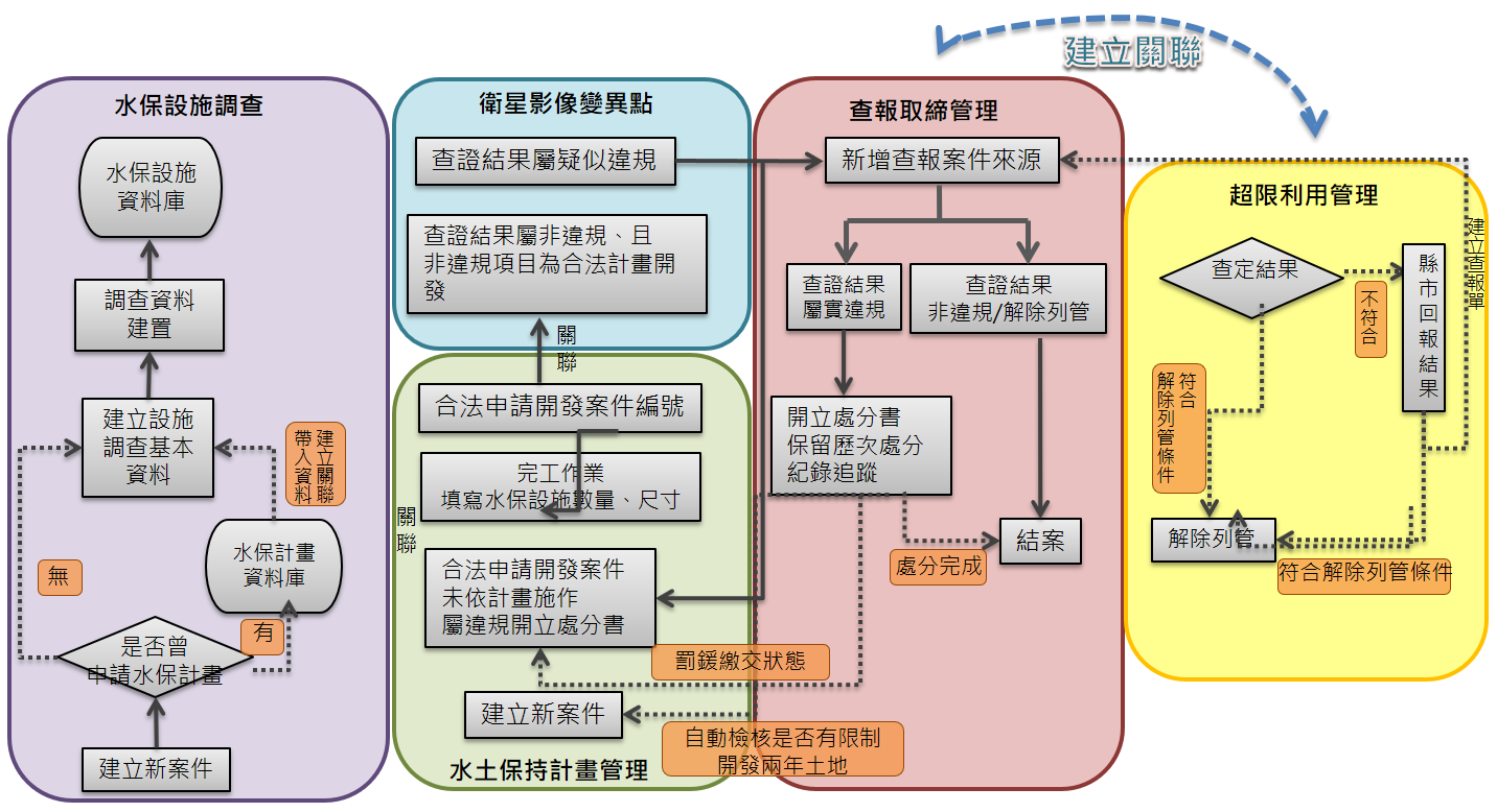
Soil and Water Conservation Bureau, Council of Agriculture, Executive Yuan mainly handles the management of hillside land in accordance with the "Regulations on the Conservation and Utilization of Hillside Land", the "Soil and Water Conservation Law" and related sub-statutes. In 2013, the five management businesses online version of hillside land including "water and soil conservation plan management", "water and soil conservation facility safety inspection", "satellite image variation point verification", >"report checking and banning" and "overuse land use management" have been developed successively.
Integrate into the "Hillside Land Management Information System" to provide a technological and systematic management tool for the hillside business managers of county and city governments, township and city offices, central ministries and technicians' associations.
In addition, in order to provide grassroots operators and the public with the ability to search for interpretations of specific hillside land use laws and regulations, a "Retrieval System for Interpretation Letters of Laws and Regulations Related to the Soil and Water Conservation Law" was also developed to achieve the goals of information disclosure, assistance to grassroots implementation, and convenient services for the people.

Project performance and benefits
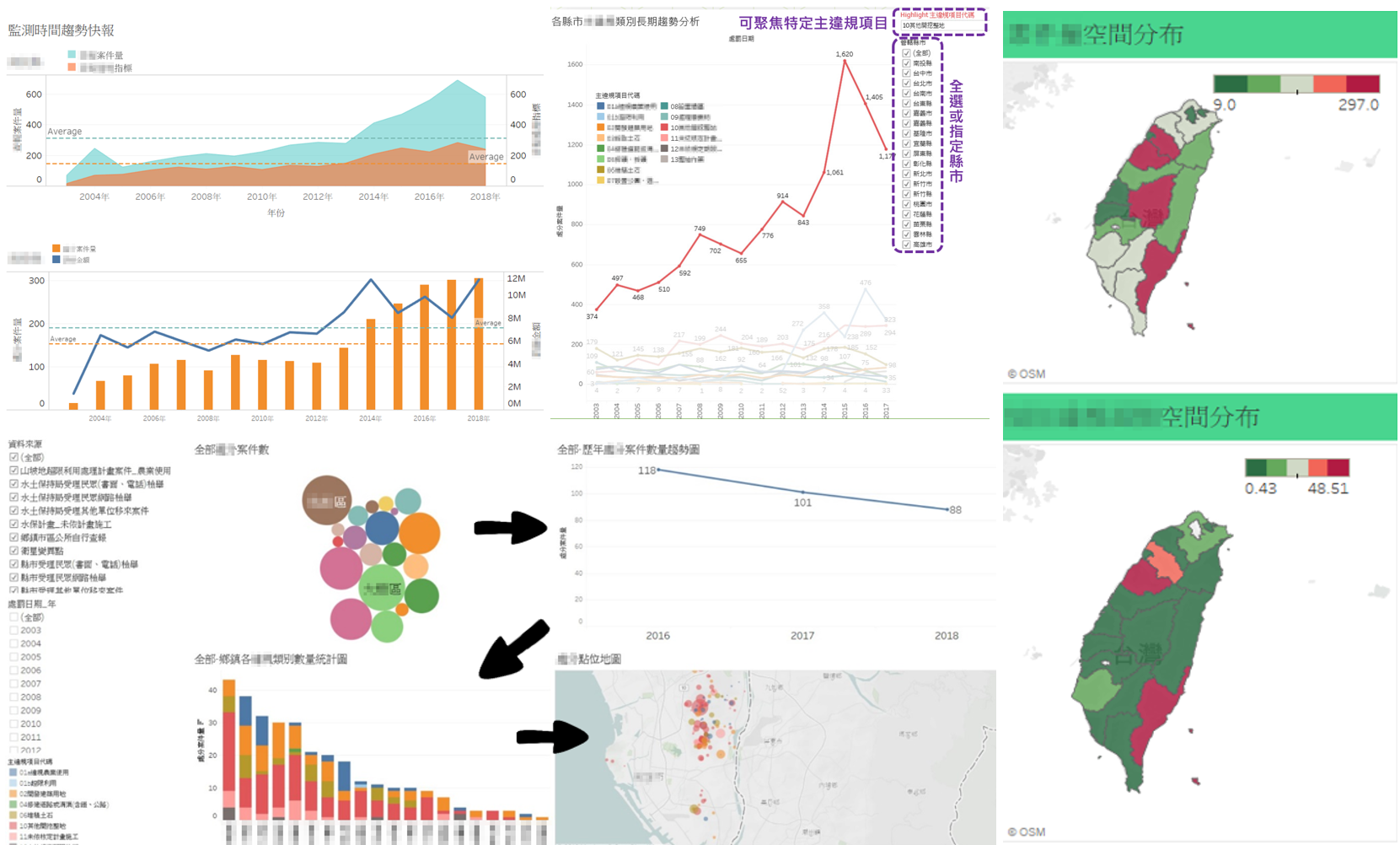
"Hillside Management Information System" introduces applications such as information and communication technology (ICT), geographic information system (GIS), remote sensing (RS) and data analysis, hoping to achieve the following management objectives:
Integrate horizontal business management information with systematic information management tools to make water and soil conservation case management more efficient and easier to save all management processes.
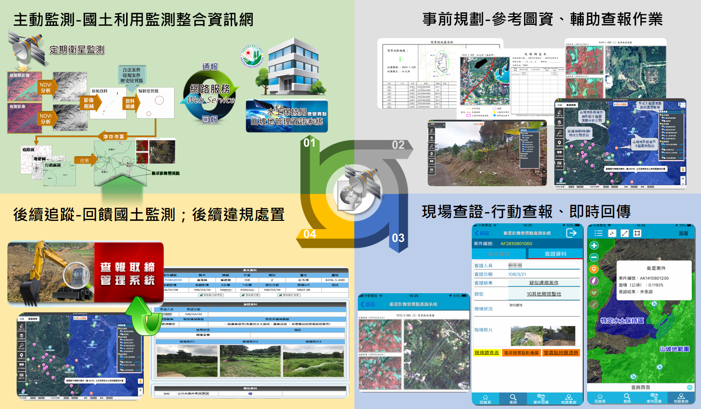
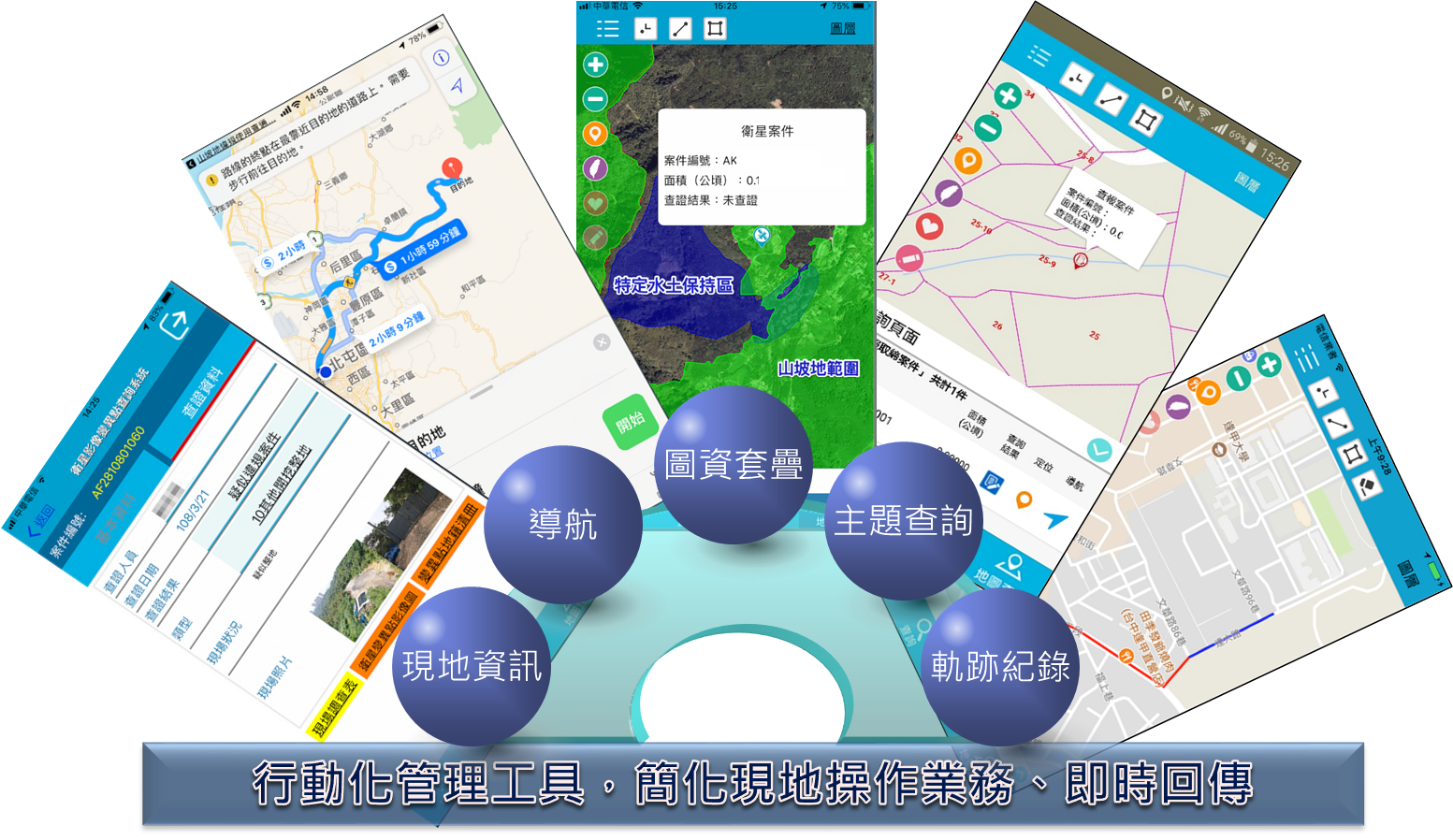
Auxiliary management such as mobile reporting system, periodic satellite image variation point notification, periodic report notification and other active and real-time information construction and rapid transmission for the integration of national land monitoring plan, in order to grasp the crux of the problem in the shortest period of time to respond immediately, take measures to prevent and control expansion or solve the problem, and minimize the damage.
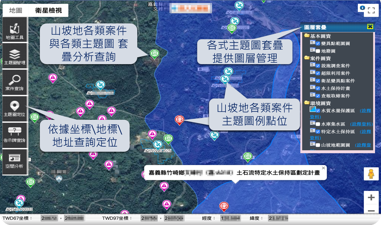
Integrate application of geographic information system (GIS) and information management system (MIS), provide data quality control and inspection mechanism, improve data quality and management effectiveness and rationality. Cross-agency resource integration, using information and communication technology and integrated map data to provide business management units with effective use of auxiliary resources, reducing heavy work, improving hillside management efficiency, and achieving the goal of resource sharing.
The visual tool (Tableau) provides operational, analytical, and strategic perspectives to test management physique, making smart management a step further.