Introduction
To assist the grassroots agricultural administration units in handling businesses such as converting paddy and dry fields to fallow, rice public grain purchases, small landlords and large tenant farmers, etc., the government has developed the "Grain Administration Spatial Information Query System" with the concept of geographic information.
Collect and manage the rice distribution maps from the aerial photos over the years, and update the farmland mound maps every year as the basis for turning them into fallow thematic maps. Use the space management concept to quickly nest and query the base year data, assist on-site inspectors to quickly search, and publish The mobile version of the on-site declaration and checking system (iOS/Android) checks on-site declarations for conversion to fallow, leasing, leased corn, and self-recovery, etc., to facilitate grain administration business management.

Project performance and benefits
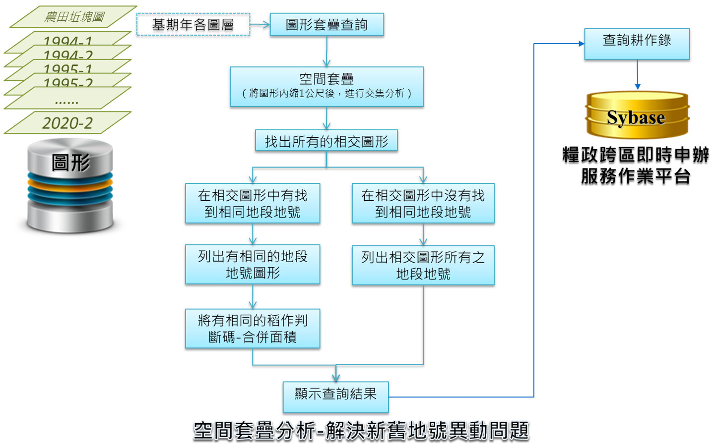
Using Geographic Information System (GIS) technology to overlay rice distribution maps over the years to solve the problem of land registration changes, and quickly search for rice cultivation records in the base year with spatial guidance.
Integrate all kinds of business declaration data from the cross-district real-time bidding service operation platform (MIS) of grain administration, dynamically produce various theme maps with farmland mound maps, flexibly use spatial data, and provide supervisors with a grasp of spatial distribution.
Use network services to interface with external map services, image services, and business data, expand complete business data and spatial geographic information, and establish a single query window with the concept of home ownership to provide business management personnel with auxiliary research and judgment information and auxiliary reporting The correctness of data and checking operations, avoiding heavy work, and providing the quality of administrative operations.