Introduction
The Water Resources Department is in charge of water resources such as rivers and reservoirs across the country. It is responsible for the management and maintenance of water conservancy facilities such as river embankments, coastal barriers, water gates, pumping stations, etc., to provide a large amount of real-time and stable water regime data throughout the country during flood seasons and typhoons And video images, so that the relevant operators can grasp the local situation in a short time, and immediately know the disaster prevention and relief information of the central and local county and city governments, to strive for the timeliness of disaster prevention and relief.
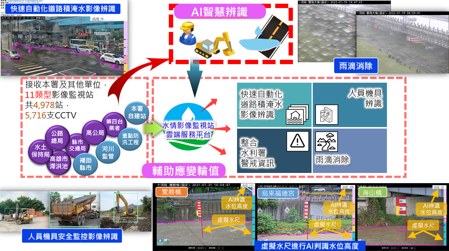
Through the cloud service platform of the water regime image monitoring station, more than 5,000 image data from self-built stations, county and city governments that are prone to flooding and flow complexes, and other external units are received, and assist the Water Resources Department during the flood season and typhoon heavy (heavy) rain In response to disaster prevention operations, a large number of real-time water monitoring images and data are provided to improve the disaster response and duty capabilities of the Water Resources Department during the flood season.

Project performance and benefits
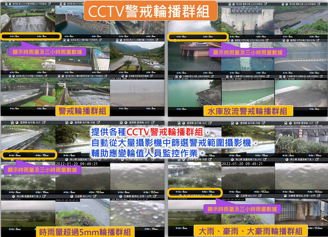
Provide a variety of image query and map display functions, provide various CCTV warning carousel groups during typhoons or heavy (heavy) rains, assist emergency response personnel to grasp water regime information in real time quickly, and provide disaster prevention centers of the Water Resources Department when they are on duty One of the important systems, and experienced the typhoon coming or the opening of the emergency response center during the flood season, and successfully completed the emergency response task; at the same time, the image interface mechanism was developed to provide the application system interface of the Water Resources Department and its affiliated units; for the historical water regime images of the Water Resources Department's self-built station Provide single image and time-lapse image download.
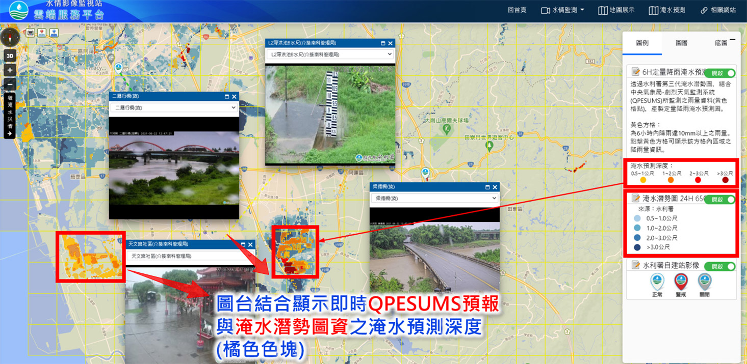
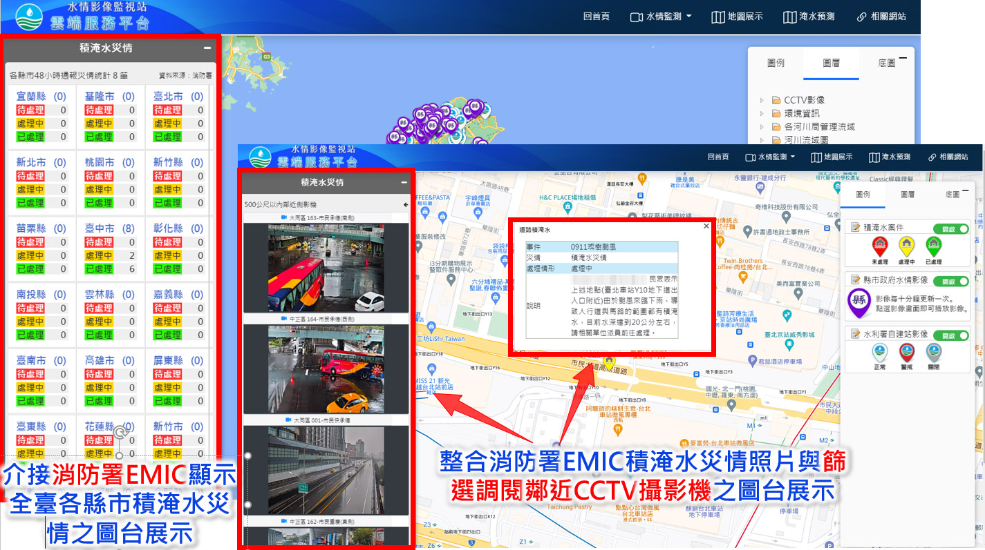
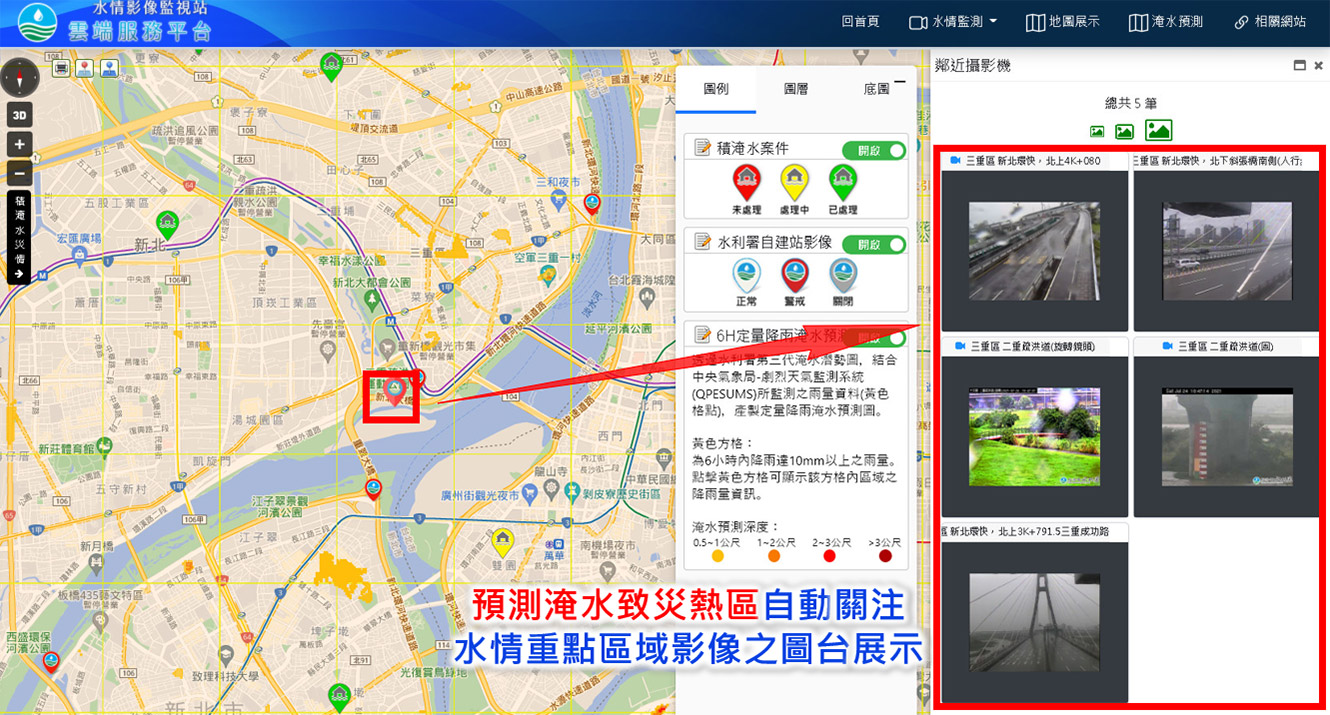
The map display function can be stacked with camera distribution, EMIC disaster information from the Fire Department, the third-generation flood potential map data from the Water Conservancy Department, QPESUMS forecast, real-time rainfall observation from the Central Meteorological Bureau, and other disaster information. Use spatial information to grasp flood-caused hot spots. . And import the Deeplab model to develop the image automatic recognition module, which can accurately identify the flooded area. The recognition results can be browsed in the automatic image recognition display module. If the warning value is reached, an email and LINE message will be sent.
Use the virtual water gauge to judge the height of the water level with AI, use advanced technology to move towards intelligent water conservancy disaster prevention, and improve the ability of the disaster prevention system. This project builds a sample database at the monitoring station of the Water Resources Department. The water level monitored by the heavy rain event in July 2011 is very close to the water level identified by the virtual water gauge. The training results can be used in real-time assistance in disaster prevention and response operations.